Bitmap Landscapes
Posted by Jon M


Using only MS Paint, Turkish artist Koray Kantarcioglu creates hyper-detailed bitmap landscapes.
Using only MS Paint, Turkish artist Koray Kantarcioglu creates hyper-detailed bitmap landscapes.
")
")
")
")
A short documentary directed by Dane Luttik reveals the projection mapping works of VJs from AntiVJ and Jean-Michel Verbeeck.


I believe it’s pretty safe to say that a lot of folks including myself, are very affectionate about Vignelli’s subway map. Both he and Harry Beck established the design direction that came to be used for most of the current day subway maps including this version by the Triboro team.
This map provides a radical take on how the Triboro team believe the New York subway system map could be treated. The poster is large format and printed in neon red. If you like the poster it is available for purchase here.


Massimo Vignelli said in a recent short documentary that “good design lasts longer” and its quite true. Although, without the preservation or relocation to a safe location, I’m not sure how much longer some of these works will last in the wild. It really is pleasant to see that gems like this subway map are still out there.
This map is at the 57 Street F station in New York City. Let’s just hope that the maintenance crew doesn’t come by and slap a Twilight poster over it.
Via imjustcreative
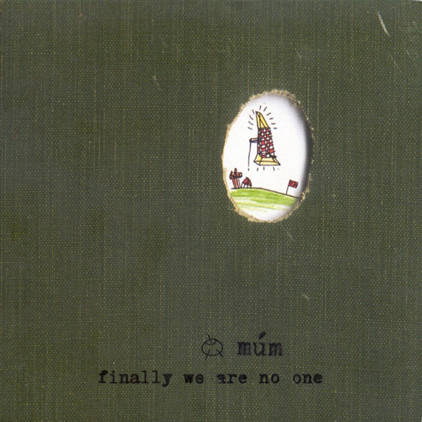
An old favorite from Icelandic group Múm’s Finally We Are No One album.
Múm – We Have a Map of the Piano
[audio:mum.mp3]
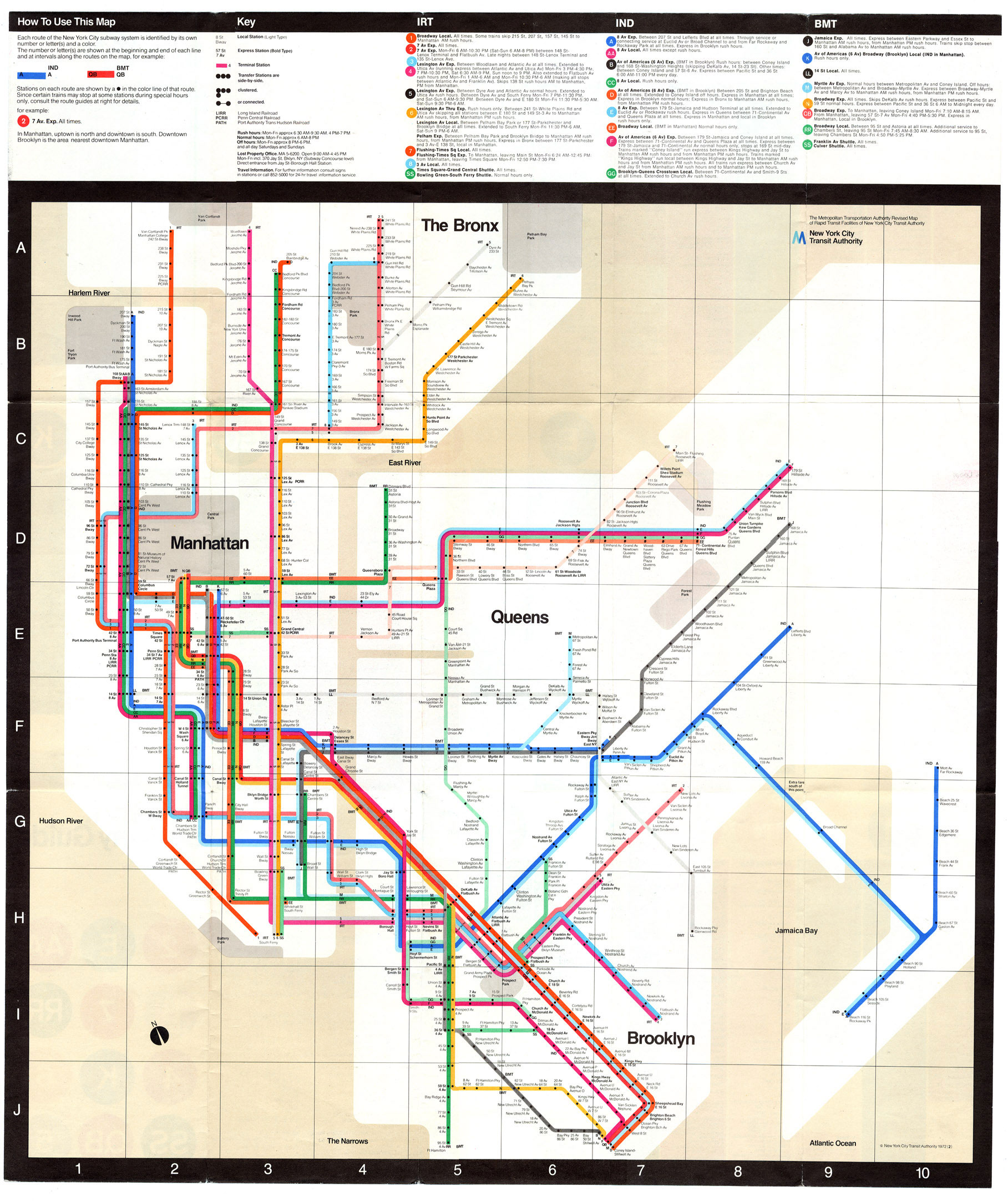
A 1972 map of the New York Subway system. Going to be using this a lot in a couple weeks so thought I would post it up. This is of course based on English graphic designer Harry Beck’s original topographic map of the London Underground (as Paul Mison pointed out in the comments, this is a later version of the map, not Beck’s original). This style of map was revolutionary at the time (1933) since it eschewed the geographically correct maps of the age for topographic representations of systems.
“A schematic diagram rather than a map, it represents not geography but relations. It considerably distorts the actual relative positions of stations, but accurately represents their sequential and connective relations with each other along the lines and their placement within fare zones.”
– From Wikipedia “Tube Map” Article
This must have been a very big logical departure for a lot of people and a lot of credit is due to Beck for having the intuition to draw the map in this new way. Of course all this is beside the fact that it’s just plain beautiful to look at and a great work of graphic art in it’s own right. To this day, Beck’s map still influences the way networked systems are represented, the above image being a great example. I don’t think many designers can claim such a revolutionary concept as their own.

by jasonjko
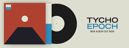
As co-founder of spatial audio platform Envelop, pioneering producer and electronic musician Christopher Willits navigates the new universe of three dimensional music composition. The technology positions sound around the listener—full spatial orientation—whether inside an Envelop space or at home with ordinary headphones. A logical step for an artist whose output, spanning over 25 releases, has inched increasingly towards rich, immersive audiovisual experiences. His new project, Horizon, culminates a career-long journey for space, physicality, and serenity in music. Fitting, a decade after Willits marked Ghostly International’s first ever exclusively digital full-length, that he brings the label its first spatial audio album.
Willits began to share his diverse vision of ambient music in the early 2000s, releasing a string of critically acclaimed albums on the 12k label. The minimal sound introduced on those recordings remains at the core of his work: warm guitar tones woven into smooth, harmonic surfaces. Willits would expand the spectrum of his catalog next through collaboration, working with Ryuichi Sakamoto, Zach Hill (Death Grips), Taylor Deupree, and, for 2014 LP Opening, the whole band of Tycho.
In the period since Opening, Willits and friends successfully crowdfunded Envelop, allowing further development of its open source software, which integrates with production tools like Ableton Live as well as virtual reality platforms, and its 3D sound space locations for performance, research, workshops, and other non-profit projects. He also composed the original score for documentary The Art of Listening, and continues to lead music production and meditation classes in San Francisco.
Both Willits’ teachings and his mission with Envelop inform the deep ambient terrain of Horizon. Spanning one hour and thirty minutes, the album surrenders to the sentient fabric of time and space, and by design, aligns with sleep patterns, meditation, and other mindful practices. This is slow music, mapped to surround listeners whether in states heightened or muted. Space, literally and figuratively, to reflect in.
The innovative 3D mix is evident within the first sweeping, spherical pan of “Comet” (access to Envelop’s software or spaces not required). As one orbits, on occasion the panoramic view touches down to the surface by way of ambisonic field recordings, like the Peruvian Amazon at night on “Return” and the Hawaiian ocean waves of “Waipio.”
This weightless motion—shifting between gaseous and textural, macro and micro—offers a unique and transcendent proprioceptive experience. Listeners are ushered through atmospheres with indeterminate length, breadth and depth. It is as if we are at once above, below, within, and alongside the skylines of sound.
SUPPORT DIGITAL

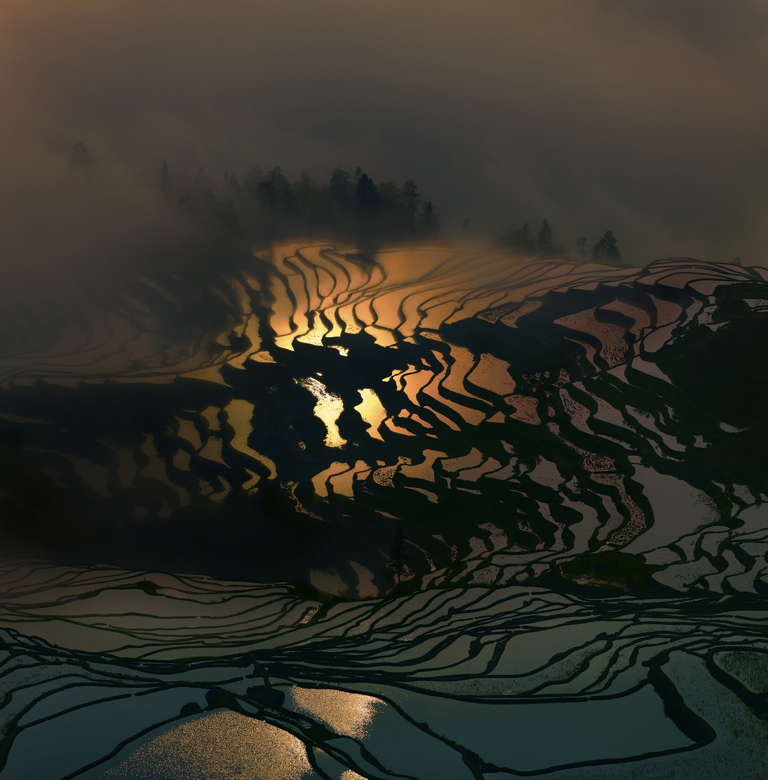
Rural China must be an absolutely amazing place to visit and photograph. A sentiment Thierry Bornier must have said to himself before leaving his job as a Chief Financial Officer at an international fashion company in New York and traveling to China to start a new life.
Thierry states..
…deep down I knew that number crunching could never satisfy my thirst for natural beauty and my love for photography.
And so, I gathered my courage and decided to see what my life would become if I did something I truly loved. I’ve never looked back.

Theirry, a French photographer specializing in capturing the landscapes of China, has been documenting the cascades of rice terraces in Yuanyang every year since permanently moving to China.
The winter temperatures here, although never freezing, are such that the terraces can only support one rice crop a year. After the harvest, from mid-September until mid-November depending on the elevation, the terraces are filled with water until April, when the planting begins.
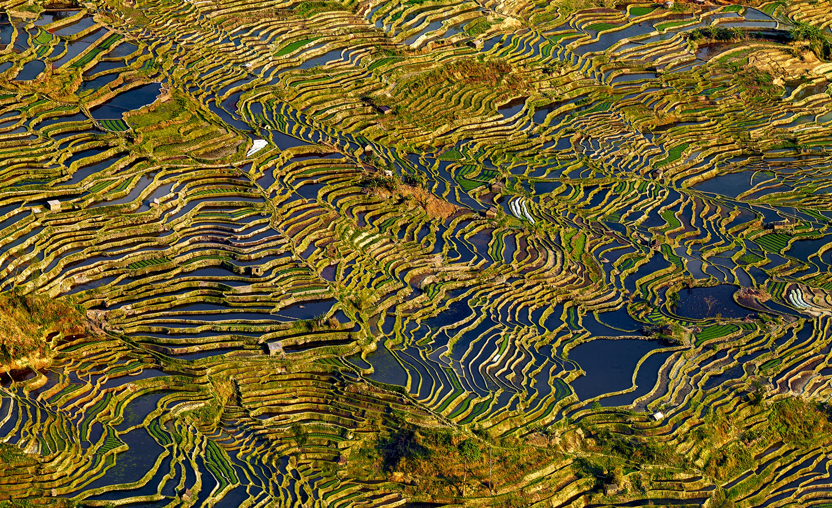
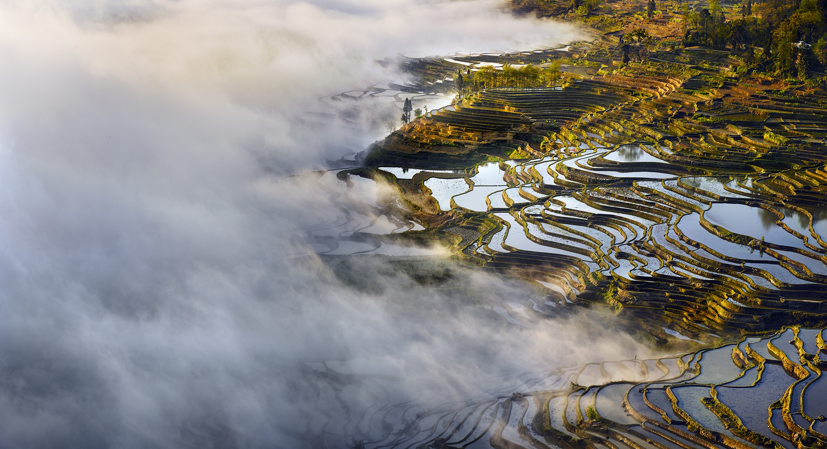
From elevations as high as 6,500 feet, the terraces undulate down into the valleys, forming intricate patterns that mirror the clouds and the sky. The fusion of man and nature creates awe-inspiring beauty, and I love the patterns and the diversity of colours that can be found at each site.
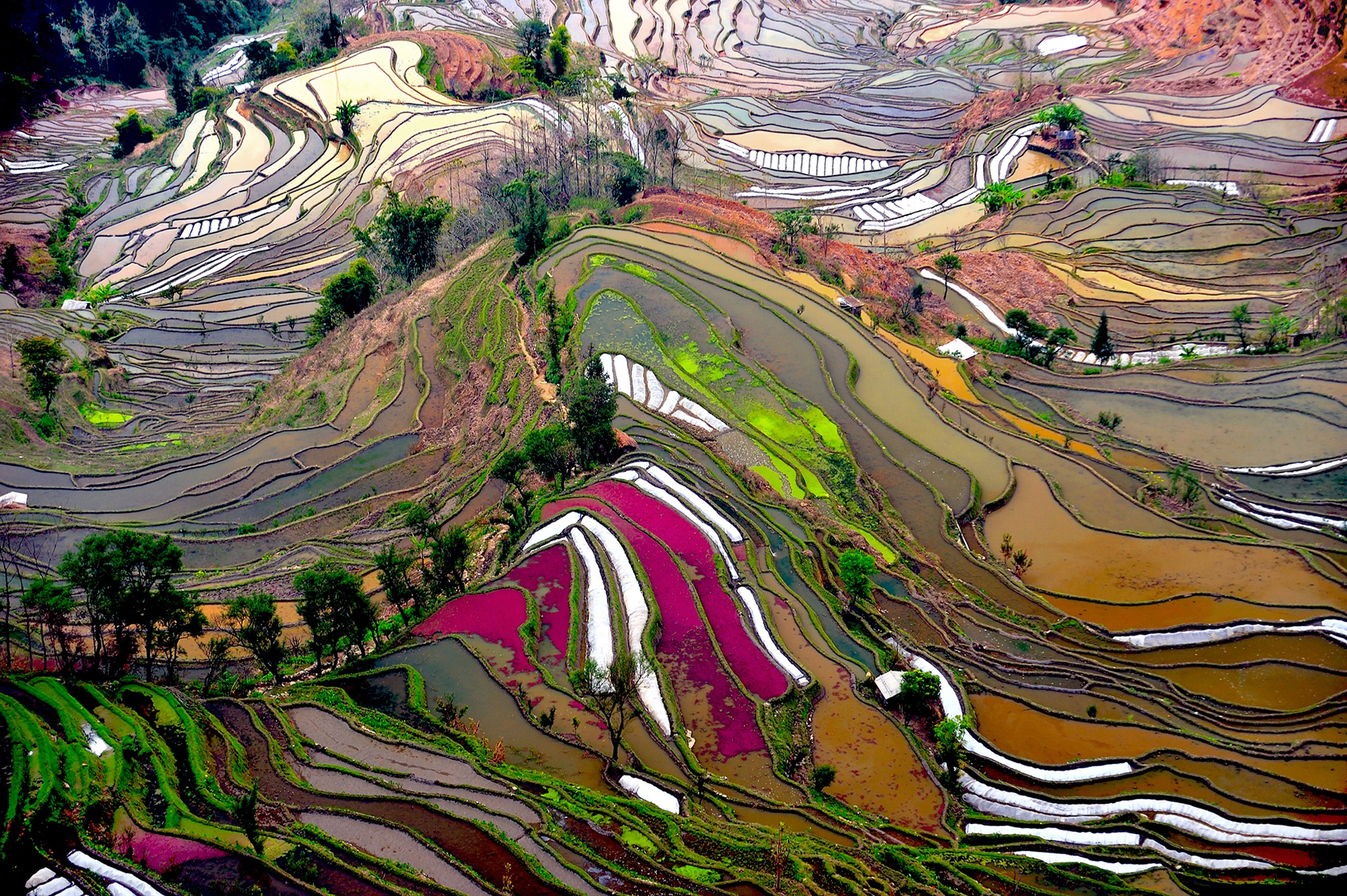
You can see more of Theirry’s work on his website: thierrybornier.net where he offers week long photography workshops in rural China beginning in February of next year.
Via: Maptia
Posted by: Owen